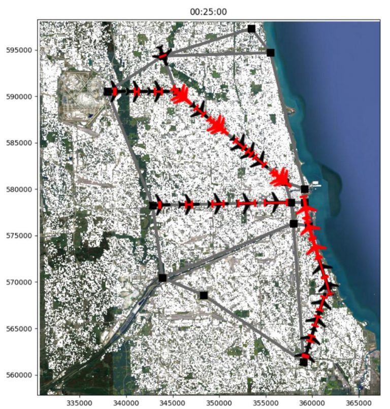
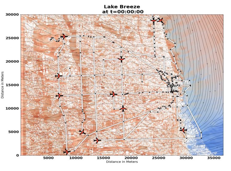
Urban Air Vehicle

NASA

Unmanned Aerial Vehicle (UAV) TRAFFIC Management Optimization in Urban Environments

Aeris Chief Scientist Andrew Annunzio “NASA is looking for innovative approaches for controlling commercial drone airspace to facilitate greater use in urban areas. This provided us with the opportunity to combine our meteorology modeling expertise with innovative machine learning algorithms. Our successes during the Phase I effort led to NASA funding Phase II.”

REQUIREMENT

Provide Unmanned Aircraft Systems Traffic Management (UTM) capability that will enable route planning and scheduling of fleets of Urban Air Mobility (UAM)/Advanced Air Mobility (AAM) vehicles.

CHALLENGE

Demonstrate feasibility of using high-resolution microscale weather in urban areas as input to optimal route and traffic avoidance algorithms. Develop a robust operational system with cycling weather prediction input and flight guidance output.

SOLUTION

Combining two key enabling innovations (LES-based microscale environmental data and graph-analytics based flight route selection) into a capability that provides flight scheduling and route guidance estimates.

Average wind speed and streamlines 50m above ground level from a JOULES domain simulation with winds from the northeast.

Aircraft within Chicago prior to running the flight scheduling and route planning algorithm.  The red aircraft denote locations of vehicles with airspace conflicts.  Black aircraft do not have conflicts.  Red bracket lines indicate location uncertainty. 

unmanned aerial vehicle

An unmanned aerial vehicle location map during Chicago lake breeze conditions.  The red and blue colors in the background depict the westerly component of the wind speed and the streamlines denote the wind direction.  The vehicle locations are denoted by the aircraft icons, with yellow highlights indicating where aircraft speed is reduced to maintain proper aircraft separation