Defense Threat Reduction Agency
Small Aircraft
Traffic Management System
Utilizing Tactical Assault Kit (TAK) technologies, SATMS provides a unified, real-time common operating picture that enhances situational awareness, communication, and coordination among all stakeholders. SATMS, developed in collaboration with AeroX, is currently deployed by government agencies, commercial drone operators, and helicopter operators, demonstrating its effectiveness in real-world applications.
REQUIREMENT
Drone operators lack the infrastructure to communicate with other airspace users. To ensure safe and efficient operations, both drone and manned aircraft operators require a real-time, unified common operating picture that provides essential situational awareness and enables coordinated decision-making.
CHALLENGE
Creating a common operating picture that connects drone operators, government agencies, and helicopter services requires not only the development of a shared operational framework but also robust data ingestion and display capabilities to ensure that all stakeholders have access to accurate, actionable information for informed decision-making.
SOLUTION
SATMS leverages proven Tactical Assault Kit (TAK) technologies to create a unified common operating picture for both drone and helicopter operators. SATMS allows operators to define, update, and share operational zones in real time, improving communication and safety.
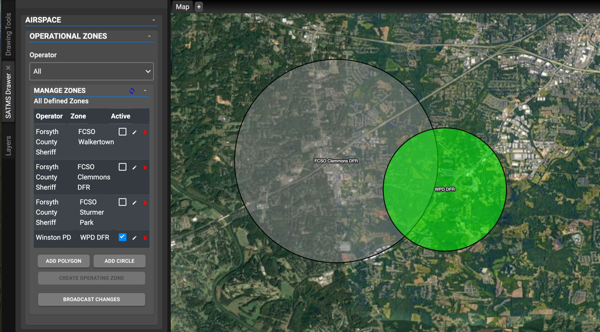
SATMS allows drone operators to define and manage operational zones directly on the map, ensuring real-time communication of zone boundaries and status. Changes made to the zones are instantly broadcasted to all relevant parties, ensuring up-to-date and accurate operational data. This dynamic system enhances flexibility and safety by enabling seamless adjustments to operational zones as flight conditions evolve.
SATMS integrates the AeroX Automatic Dependent Surveillance-Broadcast (ADS-B) feed to improve situational awareness for drone operators. This integration provides real-time tracking of manned aircraft, enabling drone operators to maintain safe distances and avoid potential conflicts with other air traffic. The ADS-B feed is a critical tool for ensuring safe and coordinated operations, particularly in shared airspace.
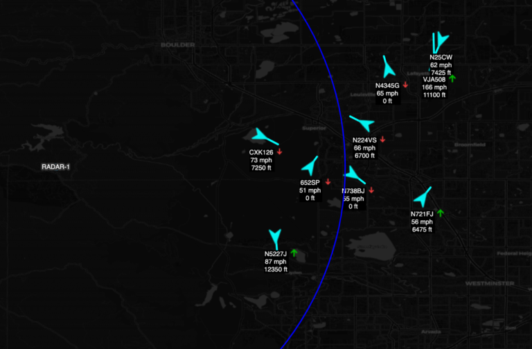

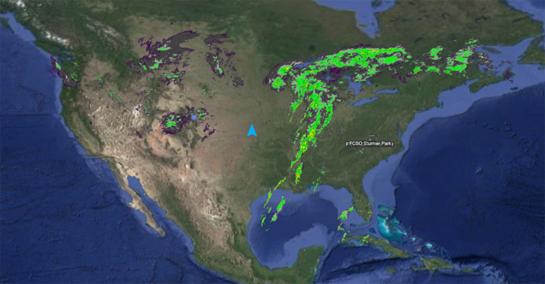
SATMS ingests and displays real-time weather radar data to support drone operators in flight planning and operational decision-making. By providing real-time insights into precipitation, storm activity, and other atmospheric conditions, SATMS enhances environmental awareness, enabling operators to adjust flight paths for improved safety and efficiency. This integration helps mitigate weather-related risks and ensures more informed, responsive operations in varying environmental conditions
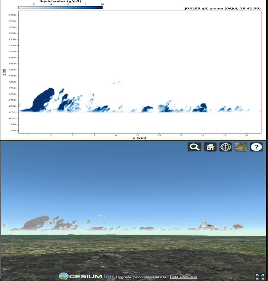
SATMS enables the integration and visualization of key weather parameters, such as cloud cover, in a three-dimensional environment. SATMS incorporates Numerical Weather Prediction (NWP) products simulated by the Joint Outdoor-indoor Urban Large Eddy Simulation (JOULES), a high-resolution micro-weather forecast model. Meter-scale forecasts from JOULES are used to enhance environmental awareness and operational safety within the Winston-Salem AeroX commercial drone testbed.
